Fun Facts (Camp Glossary)

Copyright ©, All Rights Reserved
Terminology
Description

18450 Mines Road
Rancho Los Mochos Address
94550
USPS Postal Code of Rancho Los Mochos
Acres, 686.4
Rancho Los Mochos Camp acreage
Activity field
Large open field near the auxiliary parking lot where activities take place like pioneering and camp-wide games, competitions and star-gazing take place
Alta Mesa Trail
Antelope campsite
Campsite within the Manzanita Flats camping area
Aqua Mesa Trail
Arroyo Mocho
Name of the creek that runs alongside Mines road
Auto Machinists Union
AFL Labor Union Local 1546 that purchased the property and donated the land known as Los Mochos to the Oakland Area Council in 1944.
Badger Trail
Bear campsite
Campsite within the Manzanita Flats camping area
Bear Flat Lower campsite
Campsite name within Deadwood camping area
Bear Flat Upper campsite
Campsite name within Deadwood camping area
Beaver campsite
Campsite within the Manzanita Flats camping area
Blue Oak Ridge
Blue Oak Ridge-North
Blue Oak Ridge-South
Bobcat Basin campsite
Campsite within the Manzanita Flats camping area
Bobwhite campsite
Campsite within the Manzanita Flats camping area
Buckeye Trail
Buffalo campsite
Campsite within the Manzanita Flats camping area
Bunk House
Name of the small 6 room cabin above the pool. Originally it was the Nature Lodge
Camp Dimond
Name of the former Oakland Camp which closed in 1949 and where the pool sand filter and rangers residence where moved from
Camp Masters
Original name of sleeping area on the west end of Teel Lodge. Also Camp Masters were volunteer adult leaders that helped troops during weekend events
Cardiac Hill
Name of the hill across from the camp entrance where Order of the Arrow Ceremonies were held for 50 years
Cedar Mountain
Name of the ridge and mountain at the top of camp
Ceremonies Rock
Name of the Lodge rock formation on the hill across from the camp entrance where ceremonies where held.
Chamice Trail
Name of hiking trail from 1959 located above water tank
Crow campsite
Name of campsite at the top of Blue Oak Ridge
Deadwood
Name of the camping area at the north end of camp, Developed in 1967
Deadwood Springs
Name of the spring at the end of the Badger trail.
Dimond-O Room
Name of the alcove in the dining room dedicated to the former Camp Dimond-O camp which closed in 1978.
Eagle campsite
Campsite within the Manzanita Flats camping area
EZ Livin’ campsite
Campsite within the Manzanita Flats camping area
Fence Trail
Finch Flat campsite
Campsite within the Manzanita Flats camping area
Fox campsite
Campsite within the Manzanita Flats camping area
Gopher Gulch campsite
Campsite within the Manzanita Flats camping area
Hummingbird Hollow campsite
Campsite within the Manzanita Flats camping area
Los Mochos
Original name of the camp from 1944 until 1949
Manzanita Flats Camping Area
One of the two original camping areas from 1950. Located on the flat area south of the archery range and used as wilderness campsites
Manzanita Trail
Camp trail that starts at the entrance to camp and works its way up the creek to the Archery range and then the Manzanita Flats camping area
Mary Teel
Mary Teel was a teacher who donated her 4 acre estate to the Oakland Area Council in 1941 for use as Scout Camp. When the camp was sold, the
proceeds were used to build Lodge named after her.
Mile Post 14.95
Mileage marker on Mines road at the entrance to camp
Mines Road
Name of the main road outside camp
Mocho Mesa
Name of the flagpole meeting area across from the Rangers Residence
Nature Trail
Oakland Area Council
Name of the Boy Scout Council when Los Mochos was donated to the scouts.
Observatory Hill
Name of the hill behind the dining hall. Originally an observatory was to be built at the top of the hill
Owl campsite
Campsite within the Manzanita Flats camping area
Raccoon Ravine campsite
Campsite within the Manzanita Flats camping area
Rancho Los Mochos
Rededicated name of camp from 1949
Raven campsite
Campsite within the Manzanita Flats camping area
Resource Room
Name of the room at the south end of the dining hall building
Shady Acres campsite
Campsite within the Manzanita Flats camping area
Soccer field
Before the activity field an actual Soccer field was installed, but ultimately failed due to ground squirrels and the summer heat
Sweetwater Springs
Name of the year round springs on the western hill above the archery range which provides water for the entire camp
Tarantula Terrance campsite
Campsite within the Manzanita Flats camping area
Teel Lodge
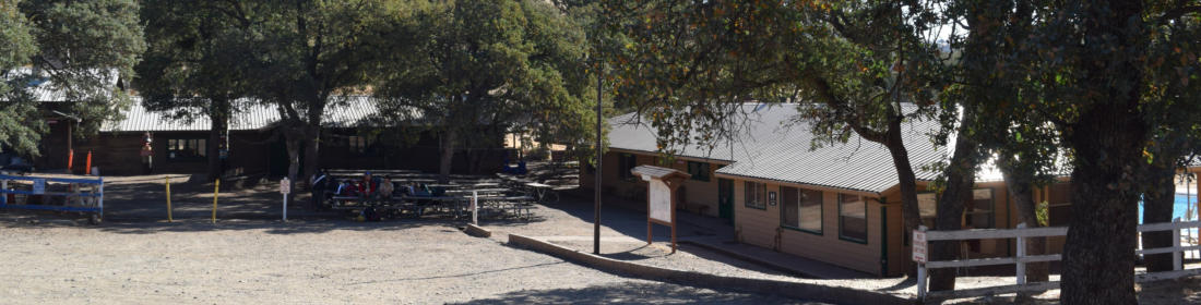
Name of the building facing the pool. Contains the training room, health lodge, Camp office and West Annex
Two Doves Campsite
Name of the accessibility campsite above the Campfire area
West Annex
Name of the sleeping quarters at the west end of Teel Lodge. Originally called Camp Masters
Windmill Trail
Name of the trail from the Camp entrance on Mines road up to the Activity field
Woodpecker Point campsite
Campsite within the Manzanita Flats camping area
Yellowjacket Point campsite
Campsite name within Deadwood camping area